Understanding the world doesn’t have to start with heavy textbooks or long explanations. Printable Map 7 Continents templates are simple learning tools that help children, and the adults guiding them, see global geography in a clearer, more approachable way.
These world map templates usually show all seven continents on one page, with clean outlines and intentional spacing that make the world feel organized rather than overwhelming. Instead of memorizing names in isolation, learners begin to understand how continents relate to one another visually. That’s what makes printable maps so powerful: they quietly guide learning while leaving plenty of room for curiosity, discussion, and exploration.


 Coloring Map The 7 Continents

 Printable Blank Maps For Coloring

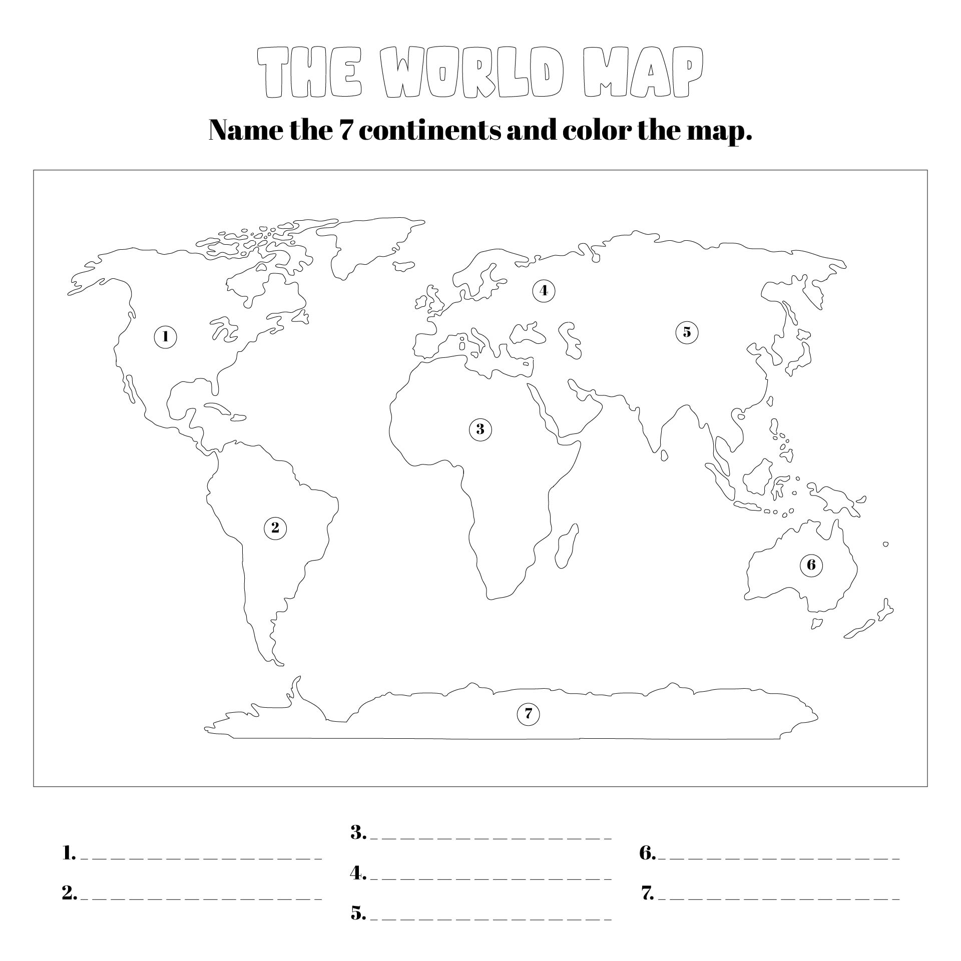
 Label The 7 Continents Worksheet

 Sketch Of The Continents

 Cut And Paste Continents

 Stained Glass Coloring Pages Printable

 Continents And Oceans Activities Worksheet

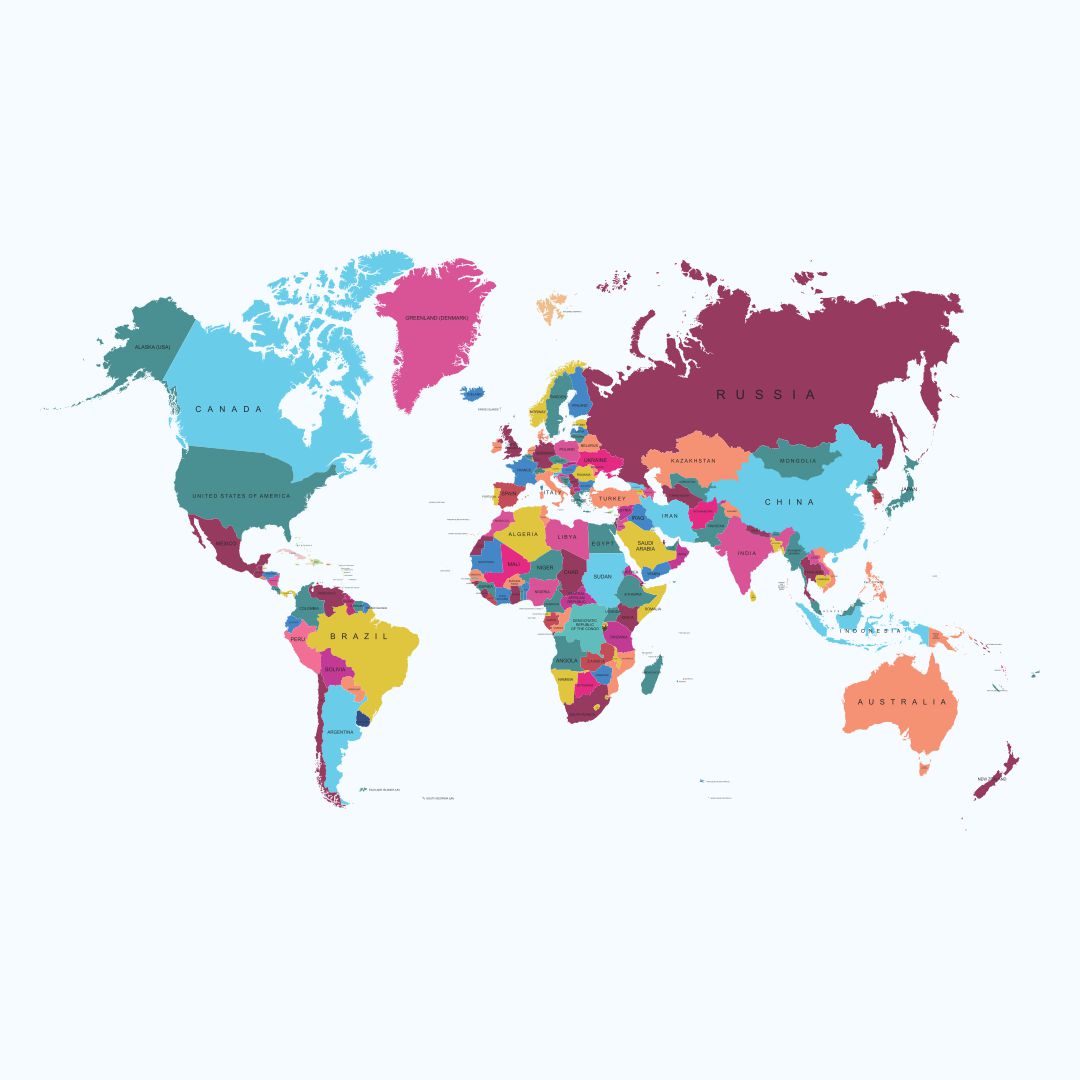
 World Map Simple 7 Continents

 World Map 7 Continents Puzzle

 Seven Continents Crossword

 Build A World Map And Continents And Oceans Jigsaw Puzzle

 Label 7 Continents And 5 Oceans Map Skill Activity Printable

 Primary School World Map Template

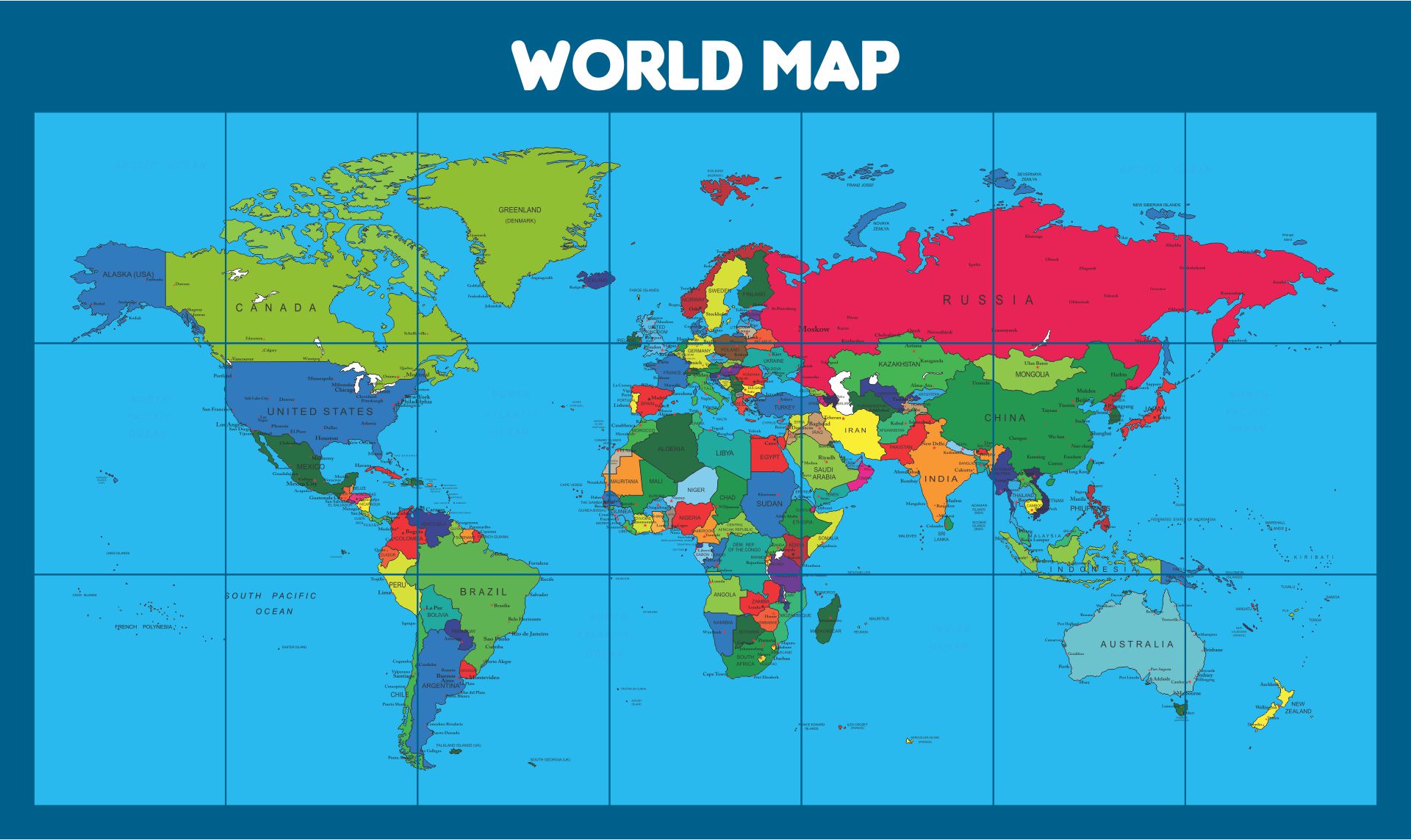
 7 Continents And 5 Oceans Printable Map

 World Geography Quiz Printable
One of the first things adults notice about 7 Continents Map templates is how clearly each continent is separated. This isn’t just a design choice, it’s a learning strategy. Clear borders help students visually distinguish landmasses without confusion, especially when they’re still new to world geography.
When borders are easy to see, kids don’t have to guess where one continent ends and another begins. That clarity reduces frustration and builds confidence early on.
Clear borders help learners by:
For teachers and parents, this design also makes explanations smoother. Instead of correcting misunderstandings later, the template itself quietly guides correct interpretation from the start.
Geography often feels big because the world itself feels big. These 7 Continents Map templates shrink that complexity into something manageable. By placing all continents on one structured page, students can quickly see the full picture without getting lost.
This faster understanding happens because:
Rather than memorizing continent names as isolated facts, learners begin to understand placement, size, and proximity. Over time, this visual familiarity speeds up recall and deepens comprehension, especially when the same template is reused across lessons.
Good learning materials don’t just give answers, they spark questions. These 7 Continents Map templates do exactly that by leaving space for curiosity. When students can clearly see the continents, they naturally start wondering about what’s beyond the outlines.
Common questions that come up include:
Because the 7 continent map template isn’t overloaded with text, students feel invited to explore rather than rushed to finish. For adults guiding the activity, this opens the door to meaningful conversations instead of one-way instruction.
Organization is an underrated learning skill, and Printable Map 7 Continents templates quietly support it. With a predictable layout and consistent structure, students learn how to sort information visually before they even realize they’re doing it.
These templates help organize learning by:
For students who struggle with scattered information, this structure feels grounding. For teachers and parents, it means less time re-explaining and more time reinforcing understanding.
Seeing the world as one connected system is a big idea, but 7 Continents Map templates make it approachable. By showing all continents together, students begin to understand that geography isn’t just separate pieces, it’s a whole.
This perspective develops when learners:
Our templates are designed to support that shift in thinking. Instead of focusing only on naming continents, students start recognizing connections that prepare them for deeper topics like climate, culture, and global movement.
One of the biggest strengths of 7 Continents Map templates is their flexibility. While they’re perfect for geography, they don’t have to stop there. Many adults use the same maps across different subjects and activities.
These templates work well for:
Because the format is clean and reusable, it fits naturally into different learning contexts. That versatility makes the template a long-term resource rather than a one-time worksheet.
Overall, clear visuals often do more for learning than long explanations. Our Printable Map 7 Continents templates offer a clean, predictable format that helps children understand global geography without confusion. Instead of facing a crowded page, students see each continent clearly, making it easier to connect locations with information. Adding a 7 continents name list alongside the map gives extra support, especially for learners who benefit from visual reinforcement.
Plus, these printable map templates are flexible enough to fit different learning styles. Teachers can use them for classroom activities, while parents can rely on them for relaxed home study sessions. Because the templates are easy to reuse, students can revisit the same map as their understanding grows.
So, download our Printable Map 7 Continents templates today and discover how a well-designed resource can support confidence, curiosity, and steady progress in geography learning!


Have something to tell us?
Recent Comments